City-usa.net
  • EUA
  • Estado
  • Bandeira
  • Mapa

Baltimore County

USA / Maryland / Baltimore County
Arbutus
Bowleys Quarters
Carney
Catonsville
Cockeysville
Dundalk
Edgemere
Essex
Garrison
Hampton
Kingsville
Lochearn
Mays Chapel
Middle River
Milford Mill
Overlea
Owings Mills
Parkville
Perry Hall
Pikesville
Randallstown
Reisterstown
Rosedale
Rossville
Towson
White Marsh
Woodlawn
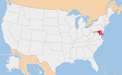
maryland map

Map of Maryland

DB-City :Baltimore County
FIPS 6-4 code :24005
Largest city :Dundalk
Elevation :High : Reisterstown 720 ft
Low : Mays Chapel 0 ft
Time zone :UTC -5
Website :http://www.co.ba.md.us
United States City
en - Condado de Maryland fr - Condado de Maryland de - Condado de Maryland es - Condado de Maryland it - Condado de Maryland pt - Condado de Maryland
nl - Condado de Maryland el - Condado de Maryland ru - Condado de Maryland ja - Condado de Maryland ko - Condado de Maryland zh - Condado de Maryland
City-USA.net O mais visitado Cidades no estado
ESTADOS UNIDOS indicam
Contato

Mapa
Sitemap
Forks, WA
Los Angeles, CA
New York, NY
Kearney, NE
Alabaster, AL
North Platte, NE
Fairland
Crofton
Perry Hall
Parkville
Pikesville
Severna Park
Aleknagik, AK
Dalzell, IL
Prairie Lake, WI
Southport, ME
Ramseur, NC
Middletown, MD
© 2023 -